We route trawlers, sportfish yachts, expedition yachts, and motor yachts from 50 to 200 ft LOA — owner-operated, or run by professional captains and management companies — and they make up roughly a quarter to a third of our clients. A motor yacht passage is planned differently from a sailing passage: the questions are what the seas will be doing on your heading, how far your fuel will take you in those conditions, and when you can safely cross and arrive.
Our routing considerations for you
- Sea state and comfort — wave height, period, and direction relative to your heading, so head, beam, and following seas stay within the limits you and your vessel set.
- Fuel range and reserves — route and speed recommendations built around your hull type, cruising speed, fuel capacity, fuel burn rate, and reserve, including the cost of head winds, head seas, and adverse current.
- Route, speed & timing — departure, routing, and speed recommendations take major ocean currents, capes, land effects, weather, and daylight into account.
- Seasonal hazards — tropical storm seasons, cold fronts, and regional cape effect and mountain gap winds.
- Alternatives en route — shelter and fuel stops along the way if conditions change.
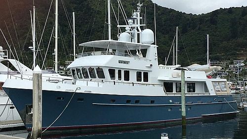
Gold Coast, Australia to Tahiti, Panama & the BVIs · 9,800 nms
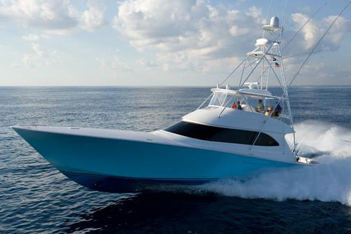
West Palm Beach to the Panama Canal · 1,200 nms
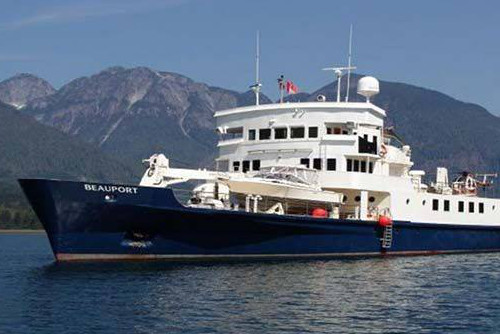
Various short passages in the NE Pacific off Mexico
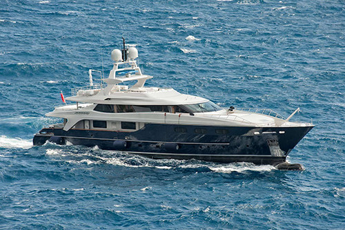
Ft Lauderdale to Gibraltar via the Azores · 3,700 nms
Passages we commonly provide routing for
We provide weather and routing for motor yachts globally, including the North and South Atlantic, North and South Pacific, and Indian Oceans, and the Caribbean and Mediterranean Seas. Passages from our gallery include:
- Florida, the Bahamas & the Caribbean — from Ft Lauderdale, Miami, West Palm Beach, and Key West to the Abacos, Jamaica, the Dominican Republic, St Martin, Antigua, the BVIs, and Bonaire, typically 400–1,200 nms.
- US East Coast — Florida to the Carolinas, New Jersey, New England, and Maine, and from Norfolk and Boston, 400–1,150 nms.
- Mexico & Central America — Florida and Texas to the Yucatán and the Panama Canal, and Guatemala's Rio Dulce to Florida, 330–1,700 nms.
- Pacific — Cabo San Lucas to Panama, Puerto Vallarta to San Diego, Panama to Seattle, and Australia's Gold Coast via Tahiti and Panama to the BVIs, 9,800 nms.
- Atlantic crossings — Ft Lauderdale to Gibraltar via the Azores, France to the BVIs, the Canaries via the Cape Verdes to Brazil, and Brazil via the Cape Verdes to Portugal and Gibraltar, 3,250–6,400 nms.
See more of the yachts and passages we’ve routed in our motor yacht gallery.
Working with captains, owners & managers
- One point of contact — you're working with Capt. Bob Cook, a USCG-licensed Master since 1985, from registration to arrival.
- Built around your vessel — your registration records your vessel's speeds, fuel, and limits, so every report is routed for your boat, not a generic one.
- Reports where you need them — by email or WhatsApp over Starlink, KVH, Viasat, Iridium, or Inmarsat, with copies to the owner or management company if you wish.
Reports & pricing
Report type and primary model (GFS or ECMWF) are agreed together before departure:
- Departure Weather Window Report — the best day and time to leave, sent 1–4 days before your tentative departure.
- Single-Model Synopsis, Weather & Routing Report — sent 1–2 days before departure and then daily.
- Dual-Model Synopsis, Weather & Routing Report — GFS and ECMWF side by side, every 2 days (daily if you choose).
Faster passages need fewer reports: a 1,000 nm passage at 10 kts takes about 4 days and typically needs 3 reports; at 30 kts it takes about 33 hours and needs 2. At our Dual-Model rate both come to $300 — the faster one because our $300 minimum applies. See How we work for full pricing.